Aragatsotn Region
Area - 2737 km 2
Population - 168100
Administrative Center - Ashtarak city
Distance from Yerevan to Ashtarak - 20 km
Lakes - Kari Lich, Lessing Lich, Mantsah, Aparan water reserv.
Rivers - Kasakh, Arkashen, Gegharot, Arzni
Highest Mountains - Aragats, Agravakar, Kakavasar
Big Cities - Ashtarak (adm. center), Aparan, Talin, Tsaghkahovit
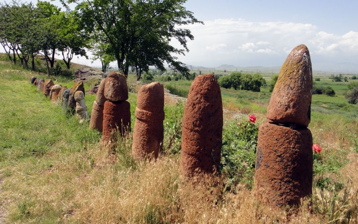
Popular places and sights - Oshakan village, Amberd fortress, Saghmosavank and Ohanavank churches, Aparan water reservoir, Aragats mount, Byurakan Astrophysical observatory, Agarak settlement, Aruchavank Cathedral, Cathedral of Talin, Saint Gevork Monastery of Mughni, Saint MesropMashtots Cathedral, the churches of Spitakavor, Karmravor, Tsiranavor, Saint Mariane and Saint Sarkis in Ashtarak and many more. Byurakan is also a place of historical monuments. There are "vishap" stone sculptures of mythical fish - guards of water, spread over slopes of mount Aragats.
Aragatsotn Region is located at the western part of the country and covers an area of 2,756 km². The capital and largest city of the province is the town of Ashtarak. The rural population of the province are 3 times bigger than the urban. Thus, the majority of the population are involved in agriculture, including farming and cattle-breeding. Being a major agricultural region, Aragatsotn contributes with 9.7% in the annual total agricultural product of Armenia.


