Khndzoresk
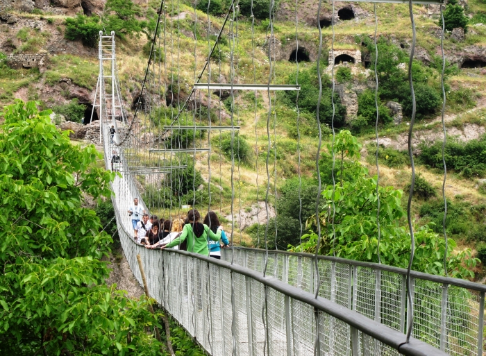
Khndzoresk is a village and rural community (municipality) in the South-East of Armenia, in the province (marz) of Syunik. The village is located to the right of Goris - Stepanakert highway, on the steep slopes of Khor Dzor (Deep Gorge), from which, according to tradition, it got its name. Crossing the bridge at the entrance of the village, the road continues towards the towns of Lachin and Stepanakert. New Khndzoresk (the current inhabited area) was built in the 1950s. The village is located at 1580m above sea level and occupies 6772,8ha. The National Statistical Service of the Republic of Armenia (ARMSTAT) reported its population as 2,260 in 2010, up from 1,992 at the 2001 census.
In the end of the 19th century Old Khndzoresk was the biggest village of Eastern Armenia. In the beginning of the 20th century the community had 8300 inhabitants (1800 households).
Khndzoresk is widely famous for its canyon with picturesque rock formations and ancient cave settlement. The artificial caves, some of which are currently used as stables and warehouses, used to be inhabited till the 1950s. In the bottom of the gorge there is St.Hripsime church, dated back to 17th century. On a spur beyond on the right side of the gorge there is Anapat (hermitage) with the tomb of Mkhitar Sparapet. The cave church of St.Tatevos can also be found nearby.


